We use cookies to give you the best experience on our site. You can find out more about the cookies we use or disable them in the cookie settings.
Interactive map
- Home
- The Liege Port Authority
- Interactive Map
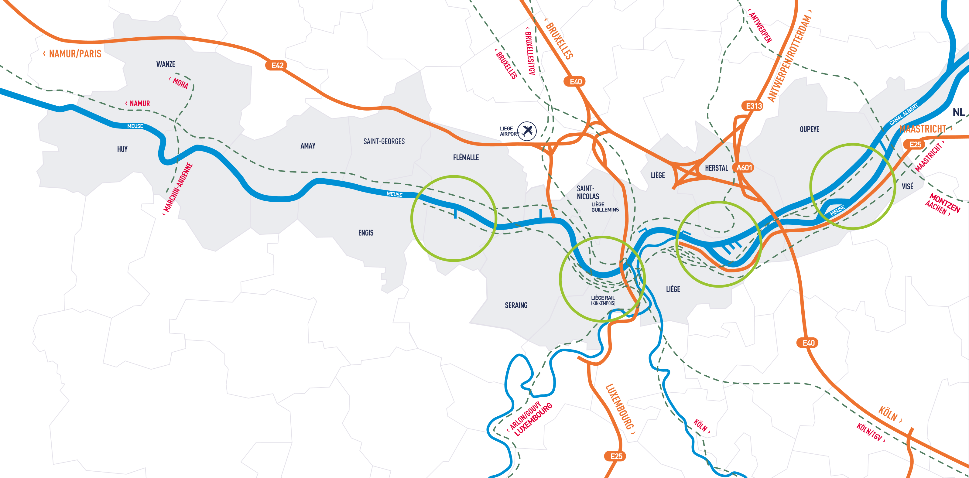
Map of our 33 port areas
TCore.BtnFilter
Port de plaisance
Port public
Port public dont le tonnage est supérieur à 500.000 T
Port public trimodal
Port public trimodal dont le tonnage est supérieur à 500.000 T
Statte
Location: City of Huy and Municipality of Wanze, left bank of the Meuse
Access: Pont de Ben-Ahin
Total area: 5 ha 42 a of usable land
Available area:3 ha 64 a
Infrastructure:
- Quay length: 1,050 m, of which 1,030 m are usable
- Allowed draught: 2.50 m
- Water level: ± 69.15
- Quay height: ± 73.00
Equipment: public lighting
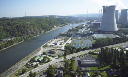
Tihange
Location: City of Huy, right bank of the Meuse
Access: Roads No. 90 and 644 (Liège - Huy)
Total area: 3 ha 78 a, including 3 ha 23 a of usable land
Available area: none
Infrastructure:
- Quay length: 541 m
- Allowed draught: 2.50 m
- Water level: ± 69.15
- Quay height: ± 71.40
Equipment: sewage, electricity, telephone, water
Ampsin
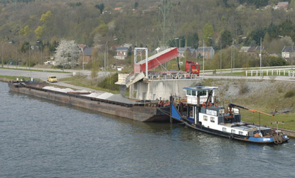
Location: Municipality of Amay, left bank of the Meuse
Access: Route 617 (Liège - Huy) - Roads No. 90 and No. 644 via the Ampsin Bridge
Total area: 1 ha 80 a of usable land
Available area: /
Infrastructure:
Quay length: 675 m
Allowed draught: 2.50 m
Water level: ± 69.15
Quay height: ± 70.15
Equipment: Possibility of electricity and telephone, public lighting
Amay
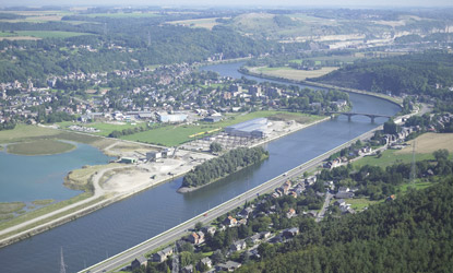
Location: Municipality of Amay, left bank of the Meuse
Access: Route N90 via le pont d'Ombret - Itinéraire 617 (Liège - Huy)
Total area: 61a, including 23a of usable land
Available area: 22a 58
Infrastructure:
- Shoreline length: 644 m
- Allowed draught: 2.50 m
- Water level: ± 64.45
- Quay height: ± 68.25
Ombret
Location : In the municipalities of Amay and Engis, right bank of the Meuse
Access : Road N90 via the Ombret Bridge - Route 617 (Liège - Huy)
Total area : 90a, including 61a of usable land
Available area : 61a
Infrastructure :
- Quay length: 400 m
- Allowed draught: 2.50 m
- Water level: ± 64.45
- Quay height: ± 68.00 (slope 1/20)
Equipment :
- 1 40t weighbridge
- 5 grain silos with a total capacity of 2,500 t
- Possibility of electricity, telephone, and water
Hermalle-sous-Huy
Location : Municipality of Engis, right bank of the Meuse
Access : Roads No. 90 and 644 - Route 617, via the Ombret Bridge
Total area : ± 3 ha 69 a, including ± 3 ha 05 a of usable land
Available area : ± 68 a
Infrastructure :
- Bank length: 946 m
- Allowed draught: 3.00 m (only in front of the quays)
- Water level: ± 64.45
- Quay height: upstream port ± 67.8 - downstream port ± 67.20
Equipment :
- 4 unloading quays (50 m)
- 1 loading quay (63 m)
- 4 storage slabs (± 5,500 m²)
Ehein
Location : Municipality of Engis, right bank of the Meuse
Access : Route 617 and roads No. 90 and 644
Total area : 2 ha 13 a of usable land
Available area : 6 a
Infrastructure :
- Length of quays: 1,244 m
- Allowed draught: 3.00 m
- Water level: ± 64.45
- Quay height: ± 66.50 downstream from the bridge and ± 68.00 upstream from the bridge
Equipment :
- 1 crane of 10 t
- Sewer, possibility of electricity and telephone
Awirs
Location : Municipality of Flémalle, left bank of the Meuse
Access : Itinéraire 617 (Liège - Huy) - Highway E42 at 8 km
Total area : 78 a, of which 31 a are usable land
Available area : none
Infrastructure :
- Shore length: 818 m
- Allowed draught: 3.00 m (mooring allowed only in front of the quay wall and at the dolphins)
- Water level: ± 64.45
- Quay height: ± 65.70
Flémalle
Location : Municipality of Flémalle, left bank of the Meuse
Access : Itinéraire 617 (Liège - Huy) - Highway E42 at 7 km
Total area : 4 ha, of which 3 ha 22 a are usable land
Available area : none
Infrastructure :
- Quay length: 730 m
- Allowed draught: 2.80 m
- Water level: ± 64.45
- Quay height: ± 66.50
Equipment :
- 1 gantry crane of 8.5 t
- 2 overhead cranes of 10 t
- 1 weighbridge of 50 t
- 2 warehouses with a total area of 500 m²
- Sewage, telephone, low voltage electricity (high voltage possible), public lighting, water
Semerie
Port of Semeries
Location : Municipality of Flémalle, right bank of the MeuseAccess :
- Road: highway E42 at 10 km and road no. 90
- Water:
- passageway of 27 m width and 44 m length
- air draft of 7.50 m
Available area : 61 a
Infrastructure :
- Quay length: 458 m
- Allowed draught: 3.00 m
- Water level: ± 64.45
- Quay height: ± 66.95
Ivoz-Ramet
Location : In the municipalities of Seraing and Flémalle, right bank of the Meuse
Access : Road no. 90 (Liège - Huy) - Highway E42 at 7 km
Total area : 6 ha 98 a, of which 6 ha 07 a are usable land
Available area : 45a
Infrastructure :
- Quay length: 1,186 m (1,110 m usable)
- Allowed draught: 2.50 m
- Water level: ± 60.00
- Quay height: ± 63.80
Equipment :
- 1 mobile crane of 5 t
- 2 mobile cranes of 15 t
- 1 weighbridge of 50 t
- Sewage, low- and high-voltage electricity, public lighting, water, telephone, gas
- 1 portal crane
Seraing
Location: Municipality of Seraing, right bank of the Meuse
Access: Route no. 90 (Liège - Huy)
Total Area: 2 ha 14 a, including 1 ha 22 a of exploitable land
Available Area: 17 a 19
Infrastructure:
- Quay length:
- In Meuse: 455 m (375 m useful)
- In basin: 488 m (175 m useful)
- Permitted draft: 2.50 m
- Water level: ± 60.00
- Quay level: ± 65.00 - ± 62.50 (154 m quay side of the road)
Equipment:
- Drainage, electricity (HT cabin nearby), public lighting, telephone, water
- Roll-on/roll-off cargo quay for heavy goods (direct road convoy access to boat)
Ougrée
Location: Municipality of Seraing, right bank of the Meuse
Access: Route no. 90 (Liège - Huy)
Total Area: 1 ha of exploitable land
Available Area: none
Infrastructure:
- Quay length: 422 m
- Permitted draft: 2.50 m (for 160 m upstream) - 3.40 m (for 245 m downstream)
- Water level: ± 60.00
- Quay level: ± 64.00
Equipment: public lighting, telephone
Jemeppe
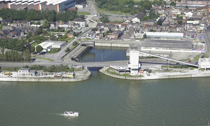
Location: Municipality of Seraing, left bank of the Meuse
Access:
- Road: Route 617 (Liège - Huy)
- Maritime:
- Channel width of 13.60 m and length of 18 m
- Air draft of 6.65 m
Total Area: 3 ha 20 a, of which 2 ha 22 a are exploitable land
Available Area: none
Infrastructure:
- Quay length:
- In Meuse: 723 m
- In basin: 360 m
- Permitted draft:
- 2.80 m over the first 180 m upstream
- 2.50 m for the rest
- Water level: ± 60.00
- Quay level: upstream: ± 64.00 to 65.00 - downstream: ± 63.50 - basin: ± 65.00
Equipment:
- 2 warehouses with a total area of 1,500 m²
- Sewage, water, telephone, low and high voltage electricity, public lighting (basin)
Sclessin
Location: City of Liège, left bank of the Meuse
Access: Route 617 (Liège - Huy)
Total Area: none (quay without adjacent land)
Infrastructure:
- Quay length: 460 m (363 m usable)
- Permitted draft: 2.50 m
- Water level: ± 60.00
- Quay level: ± 62.20
Renory
Location: City of Liège and municipality of Seraing, right bank of the Meuse
Access: Road No. 90 (Liège - Huy)
Total Area: 8 ha 07 a, including 7 ha 22 a of exploitable land
Available Area: none
Infrastructure:
- Quay length: 1,692 m
- Permitted draft: 2.50 m over 960 m and 3.00 m over 197 m
- Water level: ± 60.00
- Quay level: ± 63.50 over 960 m - ± 65.55 over 332 m downstream
Equipment:
- Rail connection (3,330 m), sewerage, low and high voltage electricity, street lighting, telephone, water
- 1 portal crane of 5 to 6 t
- 3 portal cranes of 35 to 50 t
- 2 mobile cranes of 5 and 6 t
- 2 mobile cranes of 20 and 50 t
- 3 weighbridges of 60 t
- 9 warehouses with a total area of 7,800 m²
The port is equipped for container handling between the 3 transport modes (water, road, and rail) and is served by a container barge shuttle.
For further information:
DPW Liege Container terminals
Olivier Hia
Mail: olivier.hia@liegect.be
Ardennes
Location: City of Liège, left bank of the Ourthe Canal
Access: E25 highway nearby
Total Area: 1 ha 78 a of exploitable land
Available Area: none
Infrastructure:
- Quay length: 156 m
- Permitted draft: 1.80 m
- Water level: ± 64.25
- Quay level: ± 67.60
Equipment: HT electricity, telephone
Yachts
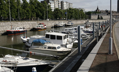
Location: City of Liège, left bank of the Meuse, between the Albert 1st Bridge and the Kennedy Bridge
Access:
- Road:
- via the Albert 1st Bridge;
- Waterway:
- via the Albert Canal and the Liège Meuse coming from Limburg and Antwerp (±120 km);
- via the Lower Meuse, the Albert Canal, and the Liège Meuse coming from Maastricht (±30 km) and the Netherlands;
- via the Upper Meuse coming from France (±110 km) and the Sambre (±60 km).
Total Area: 84 a consisting of a platform
Infrastructure:
- Quay length:
- in basin: 765 m
- in Meuse: 652 m
- Permitted draft:
- in basin: 2.00 m
- in Meuse: 3.40 m
- Water level: ± 60.00
- Quay level:
- in basin: ± 61.00 m
- in Meuse: ± 62.50 m upstream of the Albert 1st Bridge and ± 62.00 m downstream of the Albert 1st Bridge
Croisière
Location: City of Liège, left bank of the Meuse and at the foot of the Saucy footbridge
Access:
- Pedestrian: via the Saucy footbridge;
- Waterway:
- via the Albert Canal and the Liège Meuse coming from Limburg and Antwerp (±120 km);
- via the Lower Meuse, the Albert Canal, and the Liège Meuse coming from Maastricht (±30 km) and the Netherlands;
- via the Upper Meuse coming from France (±110 km) and the Sambre (±60 km).
Total Area: 10 a consisting of a platform
Infrastructure:
- Quay length: 158 m
- Permitted draft: 2.50 m
- Water level: ± 60.00 m
- Quay level: ± 61.25 m over 53 m
Equipment: water, electricity, telephone
Marcatchous
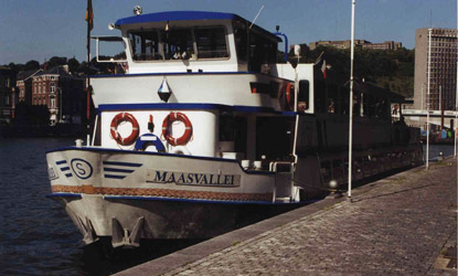
Location: City of Liège, right bank of the Meuse, at the foot of the Saucy footbridge
Access:
- Pedestrian:
- via the Saucy footbridge
- Waterway:
- via the Albert Canal and the Liège Meuse coming from Limburg and Antwerp (±120km);
- via the Lower Meuse, the Albert Canal, and the Liège Meuse coming from Maastricht (±30km) and the Netherlands;
- via the Upper Meuse coming from France (±110km) and the Sambre (±60km).
Total Area: 6 a consisting of a platform
Infrastructure:
- Quay length: 150 m
- Permitted draft: 2.50 m
- Water level: ± 60.00
- Quay level: ± 61.25 m over 100 m
Equipment: water, electricity, public lighting
Coronmeuse
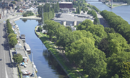
Location: City of Liège, left bank of the Meuse
Access:
- By road: Quai de Coronmeuse - Highways E25 and E40 via the Atlas V bridge
- By waterway: 14.40 m to 18.30 m wide and 102 m long canal
- Air draft: 3.40 m to 5.70 m over 21 m in length
Total Area: / (basin without adjacent land)
Available Area: /
Infrastructure:
- Quay length: 781 m
- Permitted draft: 2.50 m
- Water level: ± 60.00
- Quay level: ± 62.10 (62.30 on the right bank)
Equipment:
- Water, public lighting, electricity possibility, telephone
Eclatement
Location: Municipality of Herstal, left bank of the Albert Canal
Access: Boulevard Zénobe Gramme
Total Area: 11 ha 24 a, including 8 ha 52 a of usable land
Available Area: 66 a 94
Infrastructure:
- Quay length: 855 m
- Permitted draft: 2.50 m
- Water level: ± 60.00
- Quay level: ± 62.00
Equipment: Water, electricity, public lighting, telephone
Monsin
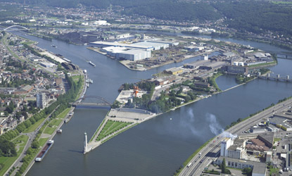
Location: Downstream of Liège, at the origin of the Albert Canal. The port is surrounded by the Albert Canal and the Meuse.
Access: Via the Marexhe, Milsaucy bridges and the barrage bridge (direct access to the E25 Liège - Maastricht motorway)
Total Area: 93 ha, including 72 ha of usable land
Available Area: 45 a 35
Infrastructure:
Quay Locations | Usable Length |
Albert Canal | 790 m |
South Dock | 1,250 m |
North Dock | 896 m |
Meuse Quay | 1,150 m |
Meuse Dock | 190 m |
Covered Dock | 220 m |
Triangular Dock | 71 m |
- Permitted Draft:
- South Dock, North Dock, Albert Canal: 3.00 m
- Covered Dock: 3.40 m
- Triangular Dock: 2.50 m
- Water level: ± 60.00 in Albert Canal - ± 54.30 in Meuse
- Quay level: ± 62.00 in Albert Canal - ± 58.65 in Meuse
Equipment:
- A 2.7 km spine track with 12 quays and roads serving the Isle Monsin installations;
- 15 km of railway lines running through the Isle Monsin; the marshalling yard covers 7 ha;
- A customs office is available to users;
- Sewer, water, telephone, low and high voltage electricity, gas, public lighting;
- A covered dock 110 m long and 26 m wide, equipped with an anti-wave gate and a closing flap, occupying a total area of 15,100 m², of which 10,000 m² are reserved for storage and handling of products sheltered from the elements. It is served by 2 quays and 3 railway tracks;
- 4 portal cranes of 9 to 15 t;
- 22 overhead cranes of 0.5 to 5 t;
- 3 overhead cranes of 12 to 15 t;
- 2 overhead cranes of 45 t;
- 7 cranes of 5 t;
- 18 weighbridges from 4 to 100 t;
- 2 portal cranes of 25 to 30 t;
- 11 overhead cranes of 7.5 to 10 t;
- 5 overhead cranes of 20 to 30 t;
- 12 cranes of 2 to 4 t;
- 1 crane of 7 t;
- 1 crane of 12 t;
- 53 grain silos with a total capacity of 25,000 t.
- 44 warehouses with a total area of 102,035 m².
Wandre
Location: City of Liège, right bank of the Meuse, upstream of the Wandre bridge
Access: Via Route No. 43 (Liège - Visé) - Direct access to the E25 and E40 motorways
Total area: 59 ha 16 a, including 56 ha 41 a of usable land
Available area: 3 ha 57 a 89
Infrastructure:
- Shore length: 1,985 m
- Permitted draft:
Navigation Notice of June 27, 2001: "LOWER MEUSE - NAVIGATION RULE - Draft: By exception to Article 1 of the particular regulation for the Meuse, the maximum draft for boats allowed to navigate is set, on a trial basis and as a pure tolerance, in the navigable pass, as follows:- From the Monsin rail bridge (cum. 115,260) to cumulative 115,900: 2.80 m
- From cumulative 115,900 to the Wandre bridge (cum. 117,874): 3.40 m"
- Water level: ± 54.30
Equipment:
- Possible rail connection, low-voltage and high-voltage electricity, street lighting, telephone, water, gas
- 9 mooring points on the Meuse for tanker docking
- 12 tunnels under the Liège - Maastricht motorway providing a link between the Meuse banks and the land
- Tank storage: 78 tanks with a storage capacity of 270,000 m³
- 45 warehouses with a total area of 100,850 m²
Herstal
Location: Municipality of Herstal, left bank of the Albert Canal
Access: Route No. 671 (Liège - Maastricht) - Direct access to the E40 motorway
Total area: 10 ha 80 a, including 9 ha 15 a of usable land
Available area: None
Infrastructure:
- Quay length: 700 m (of which 675 m are usable)
- Permitted draft: 3.00 m
- Water level: ± 60.00
- Quay level: ± 62.00
Equipment:
- Sewer system, high-voltage electricity, street lighting, cable television, telephone, water, gas
- Household waste treatment unit
- 5 cranes with a 10 t capacity
- 1 mobile crane with a 2.5 t capacity
- 4 weighbridges (60 t)
- 1 warehouse of 16,300 m²
Chertal
Location: Municipality of Herstal, right bank of the Albert Canal
Access: Via the Wandre Bridge - Direct access to highways E40 and E25
Total Area: 1 ha 14 a, including 99 a of exploitable land
Available Area: None
Infrastructure:
- Quay length: 385 m
- Permitted draft: permitted by the Walloon Public Service on the Albert Canal (for information: 3.40 m on 25.10.2016)
- Water level: ± 60.00
Users:Mategro
Hermalle-sous-Argenteau
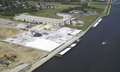
Location: Municipality of Oupeye, left bank of the Albert Canal
Access: Via the E25 motorway, Exit Hermalle-sous-Argenteau (No. 3)
Total area: 80 a, including 31 a of usable land
Available area: 11 a
Infrastructure:
- Shore length: 800 m
- Permitted draft: 3.40 m
- Water level: ± 60.00
- Quay level: ± 61.50
Liège Trilogiport
Location: Municipality of Oupeye, right bank of the Albert Canal
Access: Via the E25 motorway - Exit Hermalle-sous-Argenteau (No. 3)
Total area: ± 84 ha, including 76 ha of usable land
Available area: None
Infrastructure:
- Quay length: 2,250 m
- Permitted draft: 3.40 m
- Water level: ± 60.00
- Quay level: ± 61.50
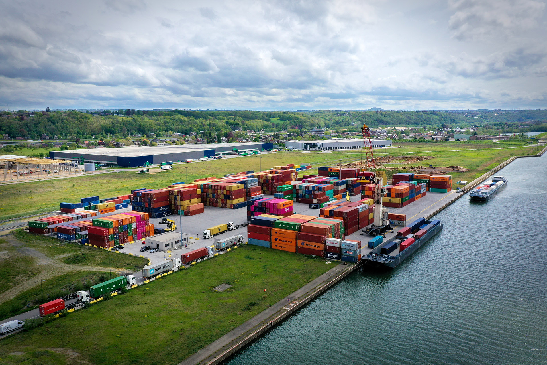
Equipment: A container terminal, rail access, water, electricity
Argenteau
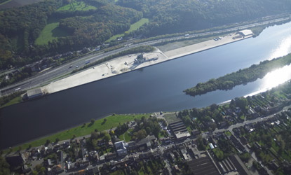
Location: Municipality of Visé, right bank of the Meuse River
Access: Route 653 (Liège - Visé) - Direct access to the E25 motorway
Total area: 7 ha 93 a, including 6 ha 73 a of usable land
Available area: None
Infrastructure:
- Usable quay length: 962.50 m
- Permitted draft: 2.40 m
- Water level: ± 54.30
- Quay level: ± 57.00
The permitted draft on the Albert Canal in Wallonia, the Lower Meuse, and the Meuse downstream of the port of Tihange is set at 3.4 m.
Subject to actual hydrological conditions, the permitted air draft is:
- On the Lower Meuse between Monsin and Hermalle-sous-Argenteau: 7 m
- On the Meuse in the province of Liège: 6.7 m
For the Meuse and Lower Meuse, the air draft may be reduced depending on the rise of the hydraulic axis when the flow increases.
Equipment:
- 2 mobile cranes with capacities of 1.5 t and 2 t
- 1 warehouse of 1,209 m²
- High-voltage electricity, telephone, gas
Visé
Location: City of Visé, right bank of the Meuse River
Access: Via the Visé bridge
Total area: 5 ha 19 a, including 4 ha 53 a of usable land
Available area: 21 a (downstream)
Infrastructure:
- Quay length: 530 m (of which 430 m are usable)
- Permitted draft: 3.40 m
- Water level: ± 54.30
- Quay level: ± 55.50
Loën
Location: Municipality of Visé, left bank of the Albert Canal
Access: Via N 602 and the Lixhe bridge
Total area: 6 ha 64 a, including 4 ha 45 a of usable land
Available area: 4 a
Infrastructure:
- Shore length: 373 m
- Permitted draft: 3.40 m
- Water level: ± 60.00
- Quay level: ± 61.00
Lixhe
Location: City of Visé, left bank of the Albert Canal
Access: Via N 602 and the Lixhe bridge (Rue des Cimentiers)
Total area: 10 ha 12 a, including 8 ha 14 a of usable land
Available area: None
Infrastructure:
- Usable quay length: 1,359 m, including a jetty
- Permitted draft: 3.40 m
- Water level: ± 60.00
- Quay level: ± 61.50
Lanaye
Location: Municipality of Visé, right bank of the Albert Canal
Access: Route 671 via the Lixhe and Lanaye bridges
Total area: 21 ha 86 a, including 20 ha 48 a of usable land
Available area: 20 ha 48 a
Infrastructure:
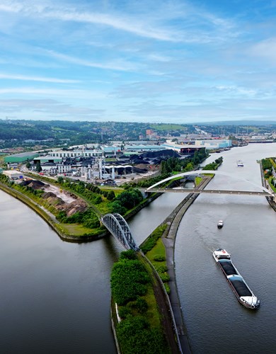
- Quay length: 2,405 m
- Permitted draft: 3.40 m
- Water level: ± 60.00
- Quay level: ± 61.50
About us
Discover the Port of Liege and its many assets
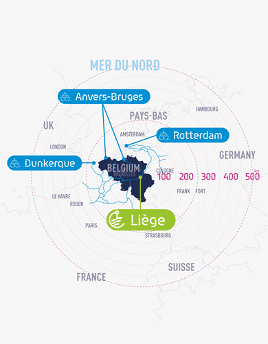
Geographical location
The Liege Port Authority and its exceptional location
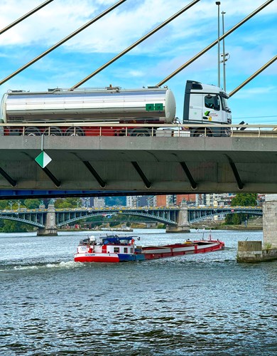
Multimodality
A multimodal strategy via a river, rail and road network
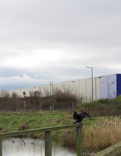
Environment
Environmental management at the Liege Port Authority